I am going to simplify the mechanism behind the phenomenon of tides to avoid making this a very lengthy post and just say that tides are caused by the gravitational pull of both the moon and the sun on the earth. The moon, being much closer to the earth than the sun, has a much greater effect on the tides than does the sun but the sun does contribute some influence. The proximity of the moon in relation to the earth is the main factor in determining the tidal range which is the difference between the high and the low tides as well as other things such as geographical features.
Typically, there are two high and two low tides per day with a roughly 6 hour period of time between each high and low tide, it is actually a little bit more than 6 hours but rounding to 6 suits our purposes just fine. Here in the Wrangell area, our biggest tidal range is about 24 feet with the smallest being about 4 feet while the biggest tidal range in the world is found on the east coast of Canada in the Bay of Fundy which is between the provinces of New Brunswick and Nova Scotia, aye. 24 feet is a lot of water but is less than half of what the Bay of Fundy sometimes gets - there is a maximum tidal range of 55 feet there! These are the extreme ranges and occur only a few times a year but even a modest change of 4 feet can cause a person some problems if they do not properly plan for it.
So, how does a person plan for the tide? With a tide book available for free from several local businesses in Wrangell! (or whichever town you are in) Since they are free and a very important reference book for anyone planning on boating, beachcombing, or really anything involving the ocean, most folks have several tide books in various places - in each boat and vehicle, float coat pockets, randomly scattered on countertops and desks, in backpacks, pretty much as many places as possible because you still sometimes can't find one when you want one!
Here are a few examples of tide books from Wrangell.
Now that you have a tide book, you probably should know how to read it so I'll make an attempt to do that now in as simple a way as possible.
Step 1: make sure your tide book is for the correct year. You can find that information on the front cover and on virtually every page inside the book.
Step 2: open the book and find the appropriate district for your location
Step 3: once you have found your district, find the page with the appropriate month for which you want to check the tide
Did you find that information at the top of the page in the above photo? Very good, now on to the next steps.
Step 4: you can see 3 columns on the page, the leftmost one contains the date and day of the month, the next has a heading of High February, meaning high tides in the month of February, and the last is Low February, meaning low tides in the month of February. These columns are then divided into subcolumns of A.M. (morning), P.M. (after noon), and time and FT for feet (like the measurement not the things below your ankles). To minimize confusion as much as possible, the P.M. tides are printed in
bold print.
Still there? Hello? Anyone?
Step 5: find the particular day that you want to know the tide for. I will use Wednesday, February 8th for this demonstration since that is what day I am doing this. Find it? Good.
Step 6: Now as you go across the 8 Wed row, you will see a big black dot which you should ignore for now, then you will come to 10:34 and then 17.7. Looking at the top of the column shows you that the 10:34 is the time in the morning and the 17.7 is the amount of feet. Looking further toward the top of the page shows you that you are in the High February column so you just discovered that at 10:34 a.m. on Wednesday, February 8th, there is a 17.7 foot high tide. Got it? It's not so hard right?
Keep moving to the right in that same row and you find in
bold type,
11:34 15.5. You are still in the High February column so you now know that at 11:34 tonight there will be a 15.5 foot high tide. You have now mastered finding the high tide on Wednesday, February 8th! (If you are a little confused just keep repeating these steps over and over until you get it or throw the book across the room)
Step 7: to find the low tide, keep moving to the right on the same row until you are in the Low February column. This works the same way as the High tide column. Did you figure out that at 5:09 p.m. there will be a -1.9 low tide? Why is the
-1.9 green? And what does -1.9 feet mean? The
green identifies the tides that are minus tides meaning that they are lower than the average low tide which would read as 0.0. Just know that a minus low tide is a very low tide and you'll be fine.
Here is what that 17.7 foot high tide looked like at 10:34.
After 10:34 a.m., the tide will slowly start to go out again, or ebb, until it reaches that 5:09 p.m. low tide at which point it will then start to slowly come back in again, or flood. An incoming tide is also called a flood tide, an outgoing tide is called an ebb tide. "Ebb" could be a useful Scrabble word.
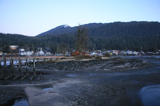
At 5:09 p.m., that -1.9 low tide looked like this.
With just some simple math, we can determine that between 10:34 a.m. and 5:09 p.m., there was 19.6 feet of change in the amount of water surrounding Wrangell - a 17.7 foot high tide goes down to that 0.0 average low tide level plus an additional 1.9 feet for the minus tide. 19.6 feet is a lot of water! Knowing this information can tell you things like what sea conditions will be like in certain bodies of water, where and when to go fishing, if it is a good day to go clam digging, or how and where to anchor your boat so that it will still be afloat when you need it to be.
This works the same regardless of where you are in the world and the photo below is of a tide book from New Zealand showing all of the same information except that the unit of measurement is in meters instead of feet.
Hopefully this was informative and helpful and that you learned something new. That was the goal anyway! The next time we discuss tides, we'll get into the Rule of 12s which tells you how much water is still coming in or going out at any point in the tide cycle.


